

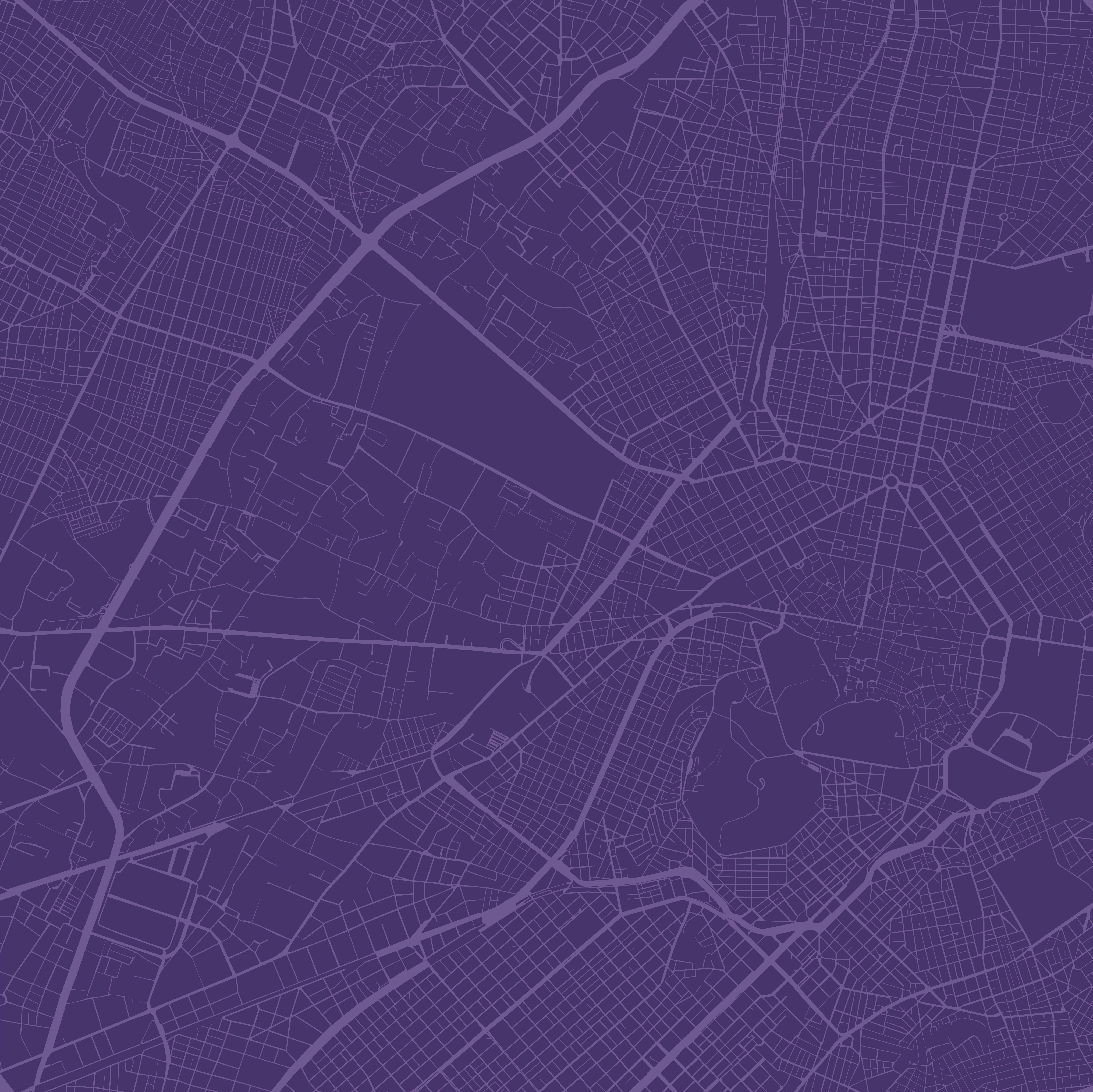
Eleonas is located west from the center of Athens. It is a wide vast area, that stands in between the hisstorical center and the National Highway, or Leoforos Kifisou. The neighboring areas that are shown in the gif are studied below, seperately, in order to obtain a level of understanding of the built environment in the city of Athens, as well as, its many different sides and typologies.

Density Study / Areas of Athens
We firstly recognise, the areas of Athens that connect to Eleonas or the ones that belong to the same administration unit. By placing the areas separately, as seen in the image, we can distinguish them by size and actually realise how big some of them, like Eleonas, are. At the same time, we divide the mini - maps of the areas, so that we can actually see the block size and the building density differencies between them. Some of them are actually bigger than the rest in size, while the smaller ones appear to concentrate the biggest building densities. The interesting point here is that the majority of them have a uniform building denisty that appears in the majority of the area, except some smaller parts, usually where they meet with another area, containing a different type of building density.

During the previous mapping session, we realised that the part of Athens that we study, contains two different building densities, that re appear in the different areas. The first one refers to a denser urban tissue, with a high concentration of buildings per block, like in the area of Omonia Square, the areas around Patision Street and Egaleo. The second one refers to a less dense urban tissue, with big open spaces between the buildings and a non-continuous skyline, like in Eleonas, in the buggest part of Tavros and Plato's Academy area. In the image we can see these examples of the two different density types, as we study the different areas, in the same scale. We cut the same square iece of each area, so that we can understand this difference.
Athens Densities
Descriptive Spatial Analysis
Industrial / Housing zone
Instead of making a map of the uses we find in Eleonas, we decide to make a descriptive spatial analysis, or a wordmap. In this kind of mapping we can actually combine different maps, such as the uses, the street traffic, the dead end streets and comments for the area in one map. The interesting thing here, is that the wordmap stands as a combination of the above mentioned without withholding information. It is threfore a really easy to understand, kind of mapping, that serves the purpose of our study at this point.
Finally we decided to study the everchanging skyline density of Eleonas. By picking the four steets that go through all our area, we focus on each one seperately, studying each of its sides. The strets that we choose are Orfeos Street, Agiou Polikarpou Street, Dimaraki Street and Agias Annis. As we see in the study shown below, all the streets appear to be less dense in the middle of the area, while on the borders of it - and especially on the eastern one -, the skyline changes radically, with high buildings close one to the other.
Skyline Density Quality Study
Eleonas / Neighboring Areas
Localise / Analysis
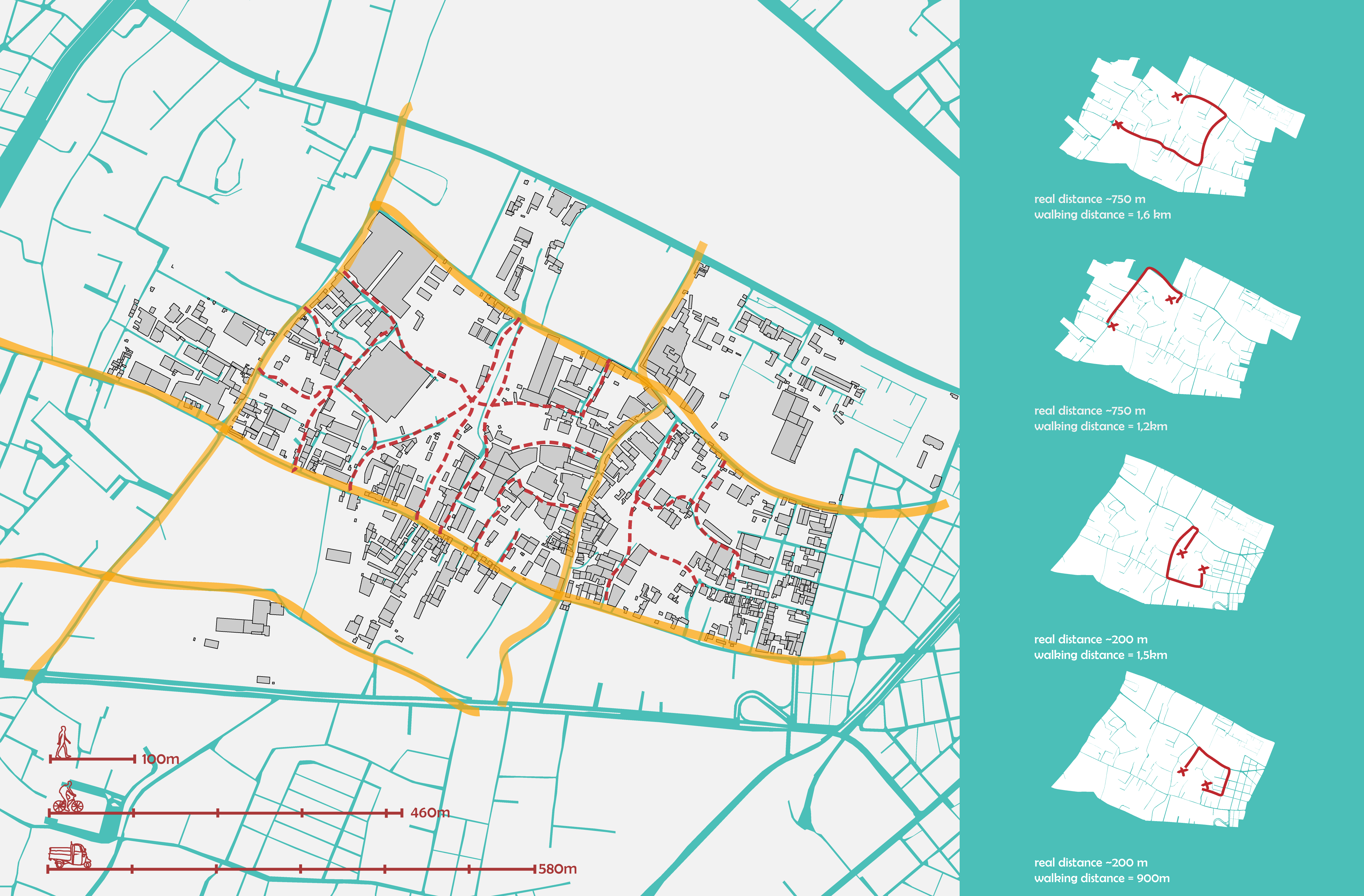
Focusing in Eleonas central lot, we realise that the lack of connectivity that we find here, is due to the size of the lots and mainly the lack of streets through them. In the diagram shown below, we see the main streets of the area, as well as the dead end streets that lead in this vast vacant area. The problem of the conectivity is shown on the right side of the image, where we locate the problem, while we show that the distance between two points of the lot, is multiplied for the person walking the area, mainly because there is not the possibility to go through the lot, but only around it.
Unpermeable lots
In this initial part of the project, we localise a series of characteristics and problems around Eleonas urban design and its connectivity to the city of Athens. By localising these characteristics, we try to form a method of reading this area, while aiming to use these characteristics as the core of our strategy and the problems, as the tool of revitalising the area, through solving them.
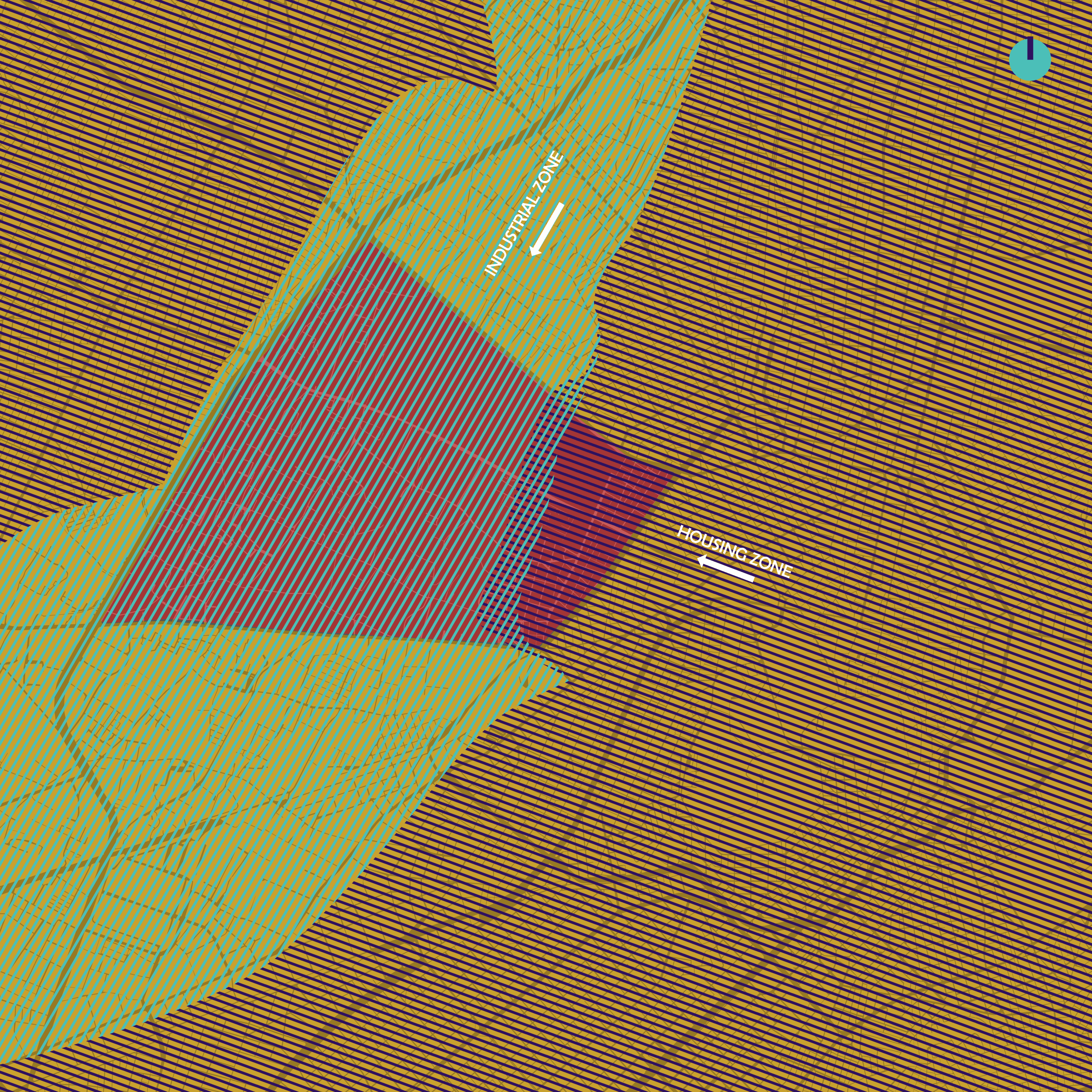
By looking over the area, and its connection with the rest of the city, we realise that there are two kinds of urban tissues running, as seen in the image, throught the city. Eleonas belongs in the non-denser kind, that runs along the E-94 highway and contains mainly industrial uses or industrial support uses such as storage houses, logistic companies, truck parking lots and car maintance shops. This industrial zone cuts Athens in half in a way, as the city has outgrown this border and has actually surrounded it. This makes this border an actual problem for the connectivity of the city, as this whole zone lays vacant inbetween.